And at the end of the century, the town picked up its obligatory Walter Scott connection: he was quartermaster of the Edinburgh Light Horse, who drilled on the Portobello sands. After being kicked by a horse during a drill, he retired to nearby Duddingston, where he finished his Lay of the Last Minstrel.
The area was developed as Victorian seaside town in the 19th century and, despite having gone through some rough times since, has reclaimed its status as a nice day out for Edinburgh folks. This post gives a little photo tour of the walk from our place in Newington to the Portobello shore, passing through some typically British neighborhoods of a sort most tourists don't really get to see.
The walk starts by skirting the southern flank of Arthur's Seat, pas Duddingston Loch.
Duddingston Loch is the source of Figgate Burn, the creek which gave the Portobello area its original name.
The road winds into Duddingston itself, a small semi-rural enclave wedged between the southern slopes of Arthur's Seat and Duddingston Loch. In addition to its Walter Scott connection, Duddingston is home to two points of interest: a small medieval church . . .
. . . and the Sheep Heid Inn, Scotland's oldest pub.
(The sign lies: on dreary days, dogs are welcome, and numerous, inside the pub as well!)
The Sheep Heid dates from the 14th century, and has played host to James VI and I, Mary, Queen of Scots, Covenanters, Jacobites, and even Bonnie Prince Charlie en route to his victory at nearby Prestonpans. Today, it's a favorite stop for hikers down from Arthur's Seat. There's even a working skittles alley dating from 1870!
Here's a quick view back over Duddingston with Crow Hill, part of Arthur's Seat/Holyrood Park, in the background.
After Duddingston, the road widens into a postwar residential area. This is the closest thing you'll find in the UK to an American-style suburb.
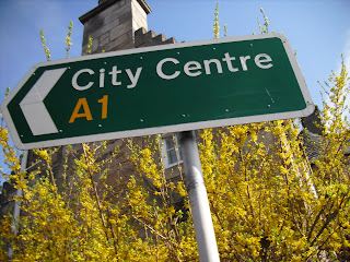
The road crosses the A1, Britain's longest official highway route, which connects Edinburgh and London.
Then more suburbs . . .
And a monstrous postwar-modern high school:
(Sorry for the blurring. It's a bit risky to take pictures of a school in the UK, especially one that's not a touristy spot like Heriot's.)
Around the bend from the high school, the road passes under an huge rail-road bridge and into Portobello proper.
Portobello works hard to tout its seasidey-ness, and about half the town is named after Brighton, southern England's most famous seaside resort.
The road into town from the west is dominated by St. James Church, a quirky bit of turn-of-the-19th-century architecture.
Generally, in the UK, the closer you get to the sea, the more Catholics. That's because so many of the 19th-century migrants to booming port towns came either from Ireland or the Highlands.
The town itself is quaint, with one bustling stretch of high street and bunch of sleepy residential lanes.
The beach seems to come out of nowhere: no sights, sounds, or smells to tell you you're near.
The view here looks east over the Firth of Forth. The distant triangular hill on the horizon is North Berwick Law. We visited North Berwick: check out our previous posts here and here.
The seaside itself is particularly British: a rundown promenade, overpriced chip shops, dingy arcades, and water too cold to swim in pretty much any time of the year.
Still, it's a pretty view, even on a hazy day like this one!
The excursion, like so many of my walks of late, was capped by a double-decker bus ride back to Newington. Here's another view of Crow Hill, this time over the suburban street with the modernist high school:


